The story in southeast Texas, including the Houston metro area, has been flooding and wind.
The first flood event happened in East Texas in the end of April, when some locations like Jasper County reported rain rates greater than six inches per hour leading to large rain totals like ten inches of rain in 24 hours in parts of East Texas. Polk County saw 11 inches of rain in two days from training thunderstorms on April 30. That storm caused the Trinity River to overflow, prompting evacuations.
It wasn’t just the one day totals that were impressive, it was the successive days of heavy to extreme precipitation that led to bigger problems. By May 6 some reservoirs and rivers were fuller than they were during Hurricane Harvey, the 2017 hurricane that dropped 40 inches of rain over a broad area, causing devastating flooding in the region.
The Associated Press reported that “Areas near Lake Livingston, located northeast of Houston, received upwards of 23 inches (58 centimeters) of rain over the past week…Areas in northeastern Harris County had a range of between 6 inches to almost 17 inches of rain in that same period.”
The flooding continues in East Texas, with the fourth flood this month occurring on May 28, caused by a complex of thunderstorms which originated in the DFW area in the early morning hours. The same storm also knocked out electricity for many customers in the region.
The region is familiar with flooding from tropical cyclones, but each of these events were caused by complexes of strong to severe thunderstorms. In some cases, the prolific precipitation amounts were caused by a phenomenon known as “training” where storms form and reform over an area (imagine each individual thunderstorm as a car on a train, with one storm after another passing over the same area). The May 28 storm was a particularly intense squall line that arrived in the area on the afternoon of the 28th after causing significant hail damage to the Dallas Fort Worth Metroplex.
Why has East Texas seen so much rain this month? One reason is that the months of May and June make up one of Texas’s two rainy seasons (the other is in October). And springtime is an active time for severe weather. So it is not unusual for Texas to see severe weather like hail, extreme wind, tornadoes, and even extreme precipitation at this time of year. A couple of things have made this particular severe weather season especially bad.
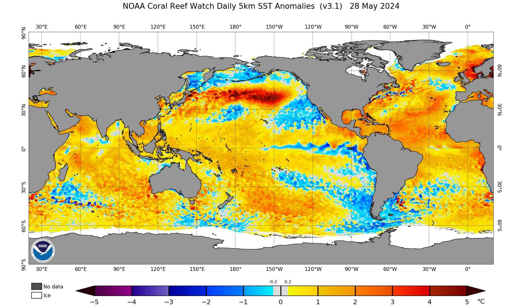
One big culprit for both heavy precipitation and severe weather is the warmer than normal Gulf of Mexico. The Gulf of Mexico is the primary source of moisture that feeds severe weather all the way from Texas to Minnesota each spring. When the Gulf is warm, like it is now, it promotes lots of evaporation of water from the surface. That creates an extremely humid airmass that is driven over Texas and hundreds of miles inland over the Great Plains by winds, both at the surface and at the upper levels.

The state climatologist reports that East Texas has already seen an increase in precipitation on the order of 15%. And that increase is projected to continue. The Extreme Weather in Texas, 1900-2036 report says that “Extreme precipitation is expected to increase in intensity on average statewide by over 20% relative to 1950-1999 and 10% relative to 2001-2020. This translates to an increase in the frequency of extreme rain of over 100% relative to the climatological expected frequency in 1950-1999. Historical trends so far represent an increase of extreme precipitation intensity by about 5-15% from 1980 to 2020, with considerable local variability.
It is worrisome that the National Oceanic and Atmospheric Administration has projected that we will have a more active than normal hurricane season in the Atlantic Basin (which includes the Gulf of Mexico). Rivers, reservoirs, and soils in East Texas remain saturated and full, meaning any further precipitation, especially heavy precipitation will almost certainly lead to more flooding.
It is timely that the Texas Water Development Board released a draft of its statewide flood plan in early May and plans to accept public comment at a public hearing on May 30 (written comment will be accepted until June 17). This is the first statewide flood plan Texas has released and it indicates that 5 million Texans currently live or work in a place that is susceptible to flooding. 1.3 million homes are at risk of flooding. That is a staggering number, but given the events of May 2024, perhaps unsurprising. Look for another post on that to come.
